New Clues Surface on Oak Island’s Lot 5. Is This Marker Leading the Team Toward Something Monumental?
Walking the Line: Did the Lot 5 Marker Lead to Something Far Greater on Oak Island?

After more than a decade of digging, drilling, scanning, and theorizing, the Oak Island team did something unexpectedly simple in Season 13 of The Curse of Oak Island—and it may have been one of the most unsettling moves they’ve ever made.
They stopped digging.
Instead, they walked.
At the center of the effort was surveyor Steve Guptill, standing at the base of the newly discovered upright stone on Lot 5—a feature already believed to be deliberately placed by human hands. Rather than excavate around it, Steve proposed a different approach: treat the stone not as a destination, but as a directional marker.


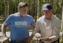
“If this was meant to point somewhere,” he said, setting up his total station, “we have to follow it exactly.”
The total station—capable of laser-precise measurements—was critical. GPS signals were unreliable beneath Oak Island’s dense canopy of old-growth pines and maples. Satellite drift, tree cover, and uneven terrain could introduce fatal errors. Only direct line-of-sight surveying would do.
Steve locked in a bearing. The line shot northwest across the island, cutting through forest, swamp margins, and terrain long ignored by previous searches.
And then the team began to follow it—step by careful step.
A Search Conducted Like a Patrol
The work unfolded less like an archaeological stroll and more like a controlled expedition.
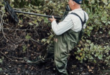
Steve Guptill and Peter Fornetti moved at the front, cutting through dense underbrush with machetes to maintain the exact bearing. Behind them, Gary Drayton swept the ground with his metal detector, moving slowly, deliberately, never straying from the invisible line.
The forest was unnervingly quiet. The only sounds were snapping branches, the hiss of leaves underfoot—and occasionally, the sharp electronic cry from Gary’s detector.
Each signal raised the same unspoken question: Was this coincidence—or confirmation?
The First Signal Changes Everything

Less than 200 feet from the Lot 5 stone, the detector let out a loud, unmistakable tone.
Gary stopped instantly.
He dropped to his knees and brushed aside moss and pine needles, then carefully scraped into the soil. Within moments, he lifted a narrow strip of rusted iron, roughly four inches long. One detail stood out immediately: a clean, square hole punched straight through the metal.
Gary didn’t hesitate.
“Barrel strap,” he said. “Eighteenth century or earlier.”
Barrel straps were used to reinforce wooden barrels designed for shipping, storage, and transport—often over long distances. On Oak Island, they have a history of appearing near major discoveries.
Gary held the corroded strip up to the camera. “Every big find on this island starts with something small. A strap. A nail. A spike. These are breadcrumbs.”
The implication was clear. Where barrels existed, organized activity followed. Storage meant planning. Planning meant purpose.
And purpose rarely existed alone.
A Line That Refused to Stay Isolated
As the team continued along the sight-line, the bearing began to reveal an unsettling pattern.
The line passed within roughly 50 feet of one of the stone features associated with Nolan’s Cross—a formation long believed to be intentionally arranged. It skimmed the edge of the swamp near the Money Pit, an area already linked to engineered flooding systems. It then intersected a cluster of low, moss-covered mounds that had been written off years earlier as natural terrain variations.
Suddenly, those dismissals felt premature.
Rick Lagina, walking near the back of the group, stopped and turned to look back along the invisible line stretching toward the distant standing stone.
“How many things have we walked past,” he asked quietly, “without knowing what they really were?”
No one answered. The silence said enough.
No Second Marker—For Now

After nearly four hours of painstaking progress, the team reached the end of the practical sight-line: a steep, rocky bluff overlooking the island’s western shoreline.
There was no second standing stone. No obvious monument. No visible marker waiting at the end of the line.
But no one seemed disappointed.
Oak Island’s landscape has been reshaped by centuries of erosion, tree growth, storms, and human interference. If another marker once stood there, it could have toppled, been buried, or been dismantled long ago.
The absence of proof did not disprove the theory.
It strengthened it.
From Single Mystery to Designed Landscape
The day ended without gold, silver, or treasure chests—but the implications were far more dangerous than any artifact.
The Lot 5 stone was no longer just an isolated anomaly. It had become a reference point—possibly the first visible node in a larger, deliberate system of alignments, markers, and engineered features.
What once seemed like scattered curiosities now hinted at something cohesive: a landscape designed, not discovered. A network rather than a single target.
Whether that system was meant for navigation, concealment, ceremony, or protection remains unknown.
But one truth became unavoidable.
The stone didn’t offer answers.
It offered direction.
And on Oak Island, following direction—especially one laid out by people history never recorded—may be the most dangerous step of all.